GEOPARQUE OESTE
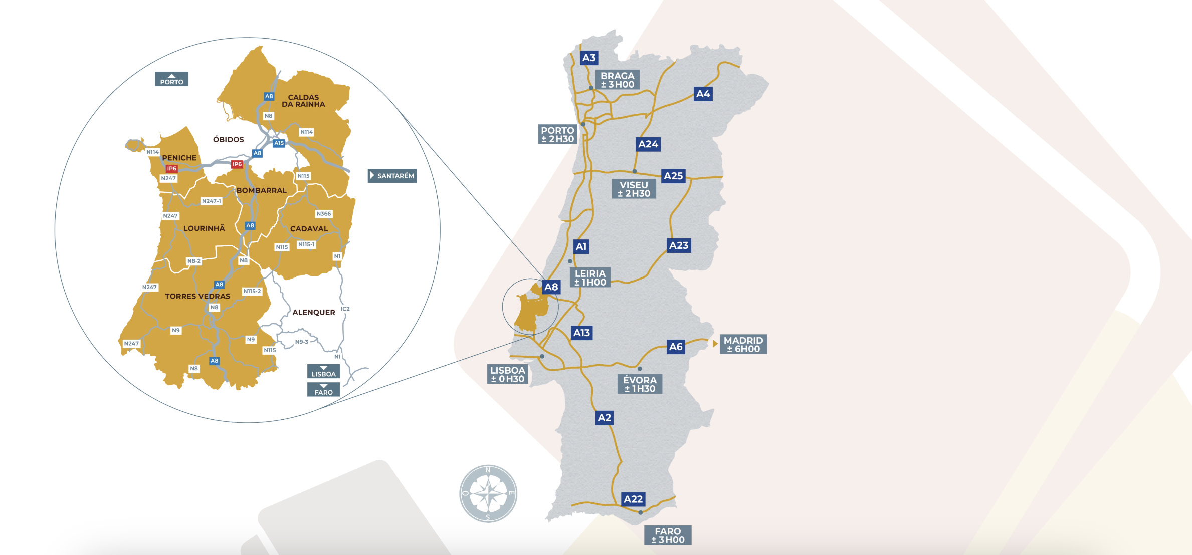
The Western Geopark encompasses 6 municipalities: Bombarral, Cadaval, Caldas da Rainha, Lourinhã, Peniche and Torres Vedras, covering a total area of 1,154 km2 . Of the 72 km of Atlantic coastline in this area, around 15 km are sandy beaches, a major attraction for locals and occasional or seasonal visitors. The geological landscapes and the exposure of geological layers in the coastal cliffs with dinosaurs also attract interested parties, researchers and scientific tourists from all over the world.
The richness and diversity of the Western Geopark is the result of the presence of rocks with ages ranging from the end of the Triassic to the Quaternary, mainly terrains from the Jurassic (77%), the lower Cretaceous (13%) and other ages (10%).
Some elements of the richness and geodiversity in this territory are:
- the enormous paleontological wealth, with 180 fossil sites (vertebrates and invertebrates) already inventoried, including more than three dozen fossil species named after localities in the West, such as the crinoid Pentacrinus penichensis , a great diversity of the first flowering plants, and 12 species of dinosaurs found for the first time in the territory, such as the Lourinhanosaurus antunesi , the Lusotitan atalaensis or the Miragaia longicollum ;
- a “Golden Nail” marking the GSSP ( Global Boundary Stratotype Section and Point ), a world-renowned location for the base of the Toarcian (Lower Jurassic) stage;
- more than 70 geosites identified and characterized, covering themes as diverse as Coastal Dynamics, Paleontology, Geomorphology, Salt Tectonics, Geological Record or Geological Resources;
- more than 200 scientific articles published about the geology of the region, as well as dozens of Doctoral and Master’s Theses already completed;
- 2 museums with a significant exhibition component associated with Geosciences (Dino Parque da Lourinhã and Museu da Lourinhã) and at least two more spaces in planning (Museum of Palaeontology of the Lusitanian Basin and Museum of the Fort of N.ª Sr.ª da Consolação);
- 7 detailed geological maps, on a scale of 1:50,000, with a total of 40 formations or geological units, many of them named after locations in the territory, such as the Lourinhã Formation, the Montejunto Formation, the Bombarral Unit or the Torres Vedras Group;
- the record of a long geological history, depicting the gradual opening of the Atlantic, with rocks from the Triassic (around 230 million years ago) to the Quaternary, highlighting the exposure of rocks from the Jurassic (200 to 145 million years ago) very rich in fossils.
These figures clearly illustrate the national and international geological importance and scientific potential of this territory as a UNESCO Global Geopark.
The region already has strong attractions for locals and visitors, and the aim of the Western Geopark is to boost this activity
What does the Geopark have to offer visitors, tourists, and locals?
 |
 |
 |
 |
 |
 |
Check the Geoparque Oeste website for more detailed information or get in touch with us to plan your experience together.
—————————————————————————————————————————————————————————————————————–
About Pata da Gaivota
![]()
This charming villa complex, featuring two private houses and six rooms, is located in a peaceful, rural area of the well-known Silver Coast, surrounded by lush landscapes and offering ocean views.